> ## Documentation Index
> Fetch the complete documentation index at: https://docs.plantpredict.com/llms.txt
> Use this file to discover all available pages before exploring further.
# RELEASE 12.19.0
November 13, 2025
# **Pro Tools**
# **Terrain Pro**
## **New Features and Improvements!**
### **Enhanced Input Configuration**
A new **input section** has been introduced to help users better organize and manage analysis parameters. Inputs are now categorized into:
* **Configuration Inputs** – Analysis and configuration settings.
* **Rack Geometry Inputs (Placeholder)** – Reserved for upcoming functionality to define rack-specific geometry directly within the interface.
* **Wind Exposure Inputs** – Parameters affecting the wind exposure calculation and rack grouping.
* **Unit Inputs** – Definition of measurement systems and units used in the analysis.
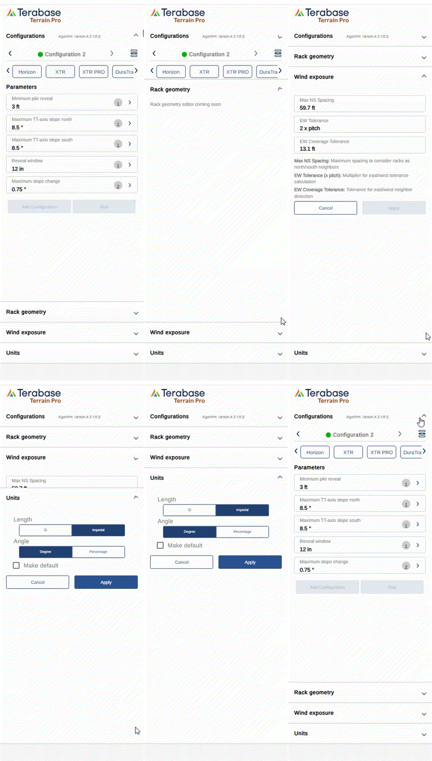 This reorganization improves clarity and streamlines the setup process for Terrain Pro analyses.
### **Editable Wind Exposure Parameters**
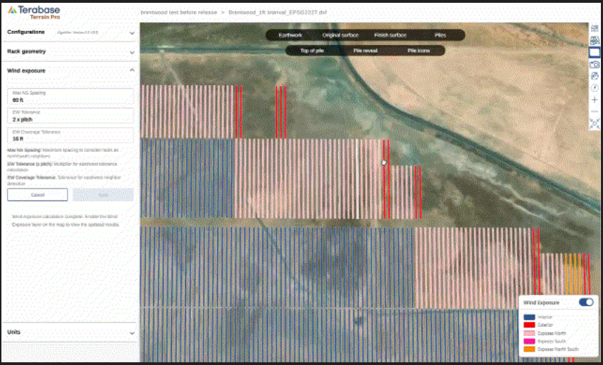
The **Wind Exposure** input section now includes editable parameters that define rack exposure and neighbor detection behavior:
* **Max N/S Spacing** – Maximum distance to treat racks as north-south neighbors.
* **E/W Tolerance (× Pitch)** – Multiplier controlling east-west tolerance during exposure calculation. This parameter defines if a rack can be considered East or West exposed
* **E/W Coverage Tolerance** – Defines how much of a rack’s edge can be exposed before it’s considered exterior.
These parameters give users flexibility to fine-tune exposure calculations for complex layouts, ensuring accurate structural analysis and rack classification.
This reorganization improves clarity and streamlines the setup process for Terrain Pro analyses.
### **Editable Wind Exposure Parameters**
The **Wind Exposure** input section now includes editable parameters that define rack exposure and neighbor detection behavior:
* **Max N/S Spacing** – Maximum distance to treat racks as north-south neighbors.
* **E/W Tolerance (× Pitch)** – Multiplier controlling east-west tolerance during exposure calculation. This parameter defines if a rack can be considered East or West exposed
* **E/W Coverage Tolerance** – Defines how much of a rack’s edge can be exposed before it’s considered exterior.
These parameters give users flexibility to fine-tune exposure calculations for complex layouts, ensuring accurate structural analysis and rack classification.
 **3D Visualization of Piles and Rack Bays**\
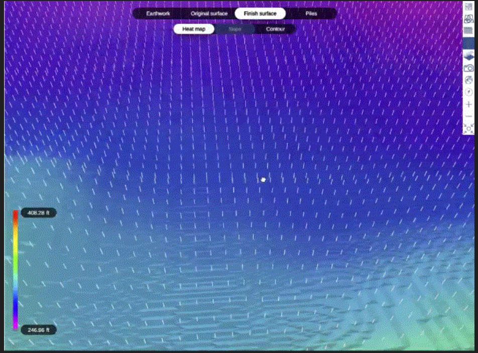
The **Finish Surface** view now includes the ability to display **3D pile and rack bay layers**, offering a more realistic visualization of post-grading conditions.
* This feature is available for Terrain Pro analyses generated from **Design Pro** configurations and **DXF imports**, where rack geometry is explicitly defined or extracted.
* For CSV or Excel-based inputs, only the **pile 3D extrusion** is shown on the finish surface.
Users can now easily visualize rack elevation, pile depth, and structure profiles in context with the proposed finish surface.
**3D Visualization of Piles and Rack Bays**\
The **Finish Surface** view now includes the ability to display **3D pile and rack bay layers**, offering a more realistic visualization of post-grading conditions.
* This feature is available for Terrain Pro analyses generated from **Design Pro** configurations and **DXF imports**, where rack geometry is explicitly defined or extracted.
* For CSV or Excel-based inputs, only the **pile 3D extrusion** is shown on the finish surface.
Users can now easily visualize rack elevation, pile depth, and structure profiles in context with the proposed finish surface.
 ### **Pile Configurator Enhancements**
The pile configurator now tracks, in addition to user-edited changes in the pile binning table, the **preferred data source** for pile type selection — whether it originates from **imported data** or is calculated using the **Wind Exposure module**.
This enhancement provides greater transparency and control over how pile types are defined and maintained across Terrain Pro analyses, improving both accuracy and consistency in design workflows.
## **Bug Fixes**
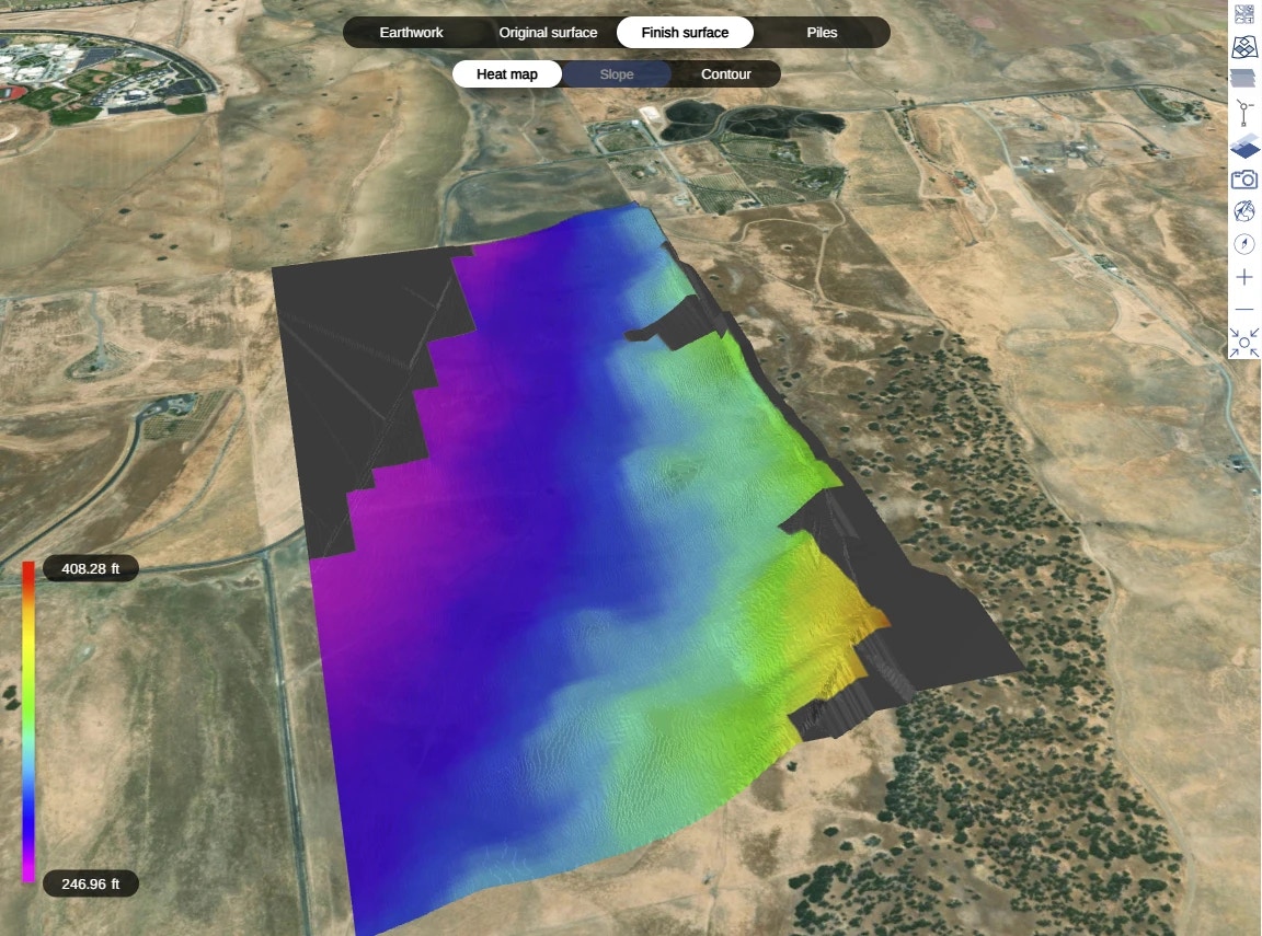
* **Gradient Color Consistency:** Resolved a mismatch between the gradient colors displayed on the **Original Surface** and **Finish Surface** maps and their corresponding legend. The gradient visualization now accurately reflects elevation values across both map views.
### **Pile Configurator Enhancements**
The pile configurator now tracks, in addition to user-edited changes in the pile binning table, the **preferred data source** for pile type selection — whether it originates from **imported data** or is calculated using the **Wind Exposure module**.
This enhancement provides greater transparency and control over how pile types are defined and maintained across Terrain Pro analyses, improving both accuracy and consistency in design workflows.
## **Bug Fixes**
* **Gradient Color Consistency:** Resolved a mismatch between the gradient colors displayed on the **Original Surface** and **Finish Surface** maps and their corresponding legend. The gradient visualization now accurately reflects elevation values across both map views.
 # **PlantPredict**
***
### **Weather File Improvements**
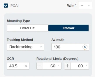
* When importing a new weather file with POAI data, decimal inputs are now accepted for GCR%.
# **PlantPredict**
***
### **Weather File Improvements**
* When importing a new weather file with POAI data, decimal inputs are now accepted for GCR%.
 * Wind Gust data is now included when exporting weather data.
* When choosing or updating a weather file for a prediction, newly added files will now correctly show in the available list immediately.
* Corrected unit-of-measurement labels for GHI, DHI, and DNI.
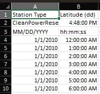
* Date & Time columns are now formatted correctly upon export
* Wind Gust data is now included when exporting weather data.
* When choosing or updating a weather file for a prediction, newly added files will now correctly show in the available list immediately.
* Corrected unit-of-measurement labels for GHI, DHI, and DNI.
* Date & Time columns are now formatted correctly upon export
 * Updated NSRDB requests to use the new v4 ‘GOES’ endpoints.
### **Bug Fixes:**
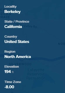
* Project elevation now correctly converts to FT when Imperial is toggled on
* Updated NSRDB requests to use the new v4 ‘GOES’ endpoints.
### **Bug Fixes:**
* Project elevation now correctly converts to FT when Imperial is toggled on
 * Fixed an issue that prevented PVC files from uploading for predictions using some Solcast weather files.
This documentation is built and hosted on [Mintlify](https://mintlify.com), a developer documentation platform.
* Fixed an issue that prevented PVC files from uploading for predictions using some Solcast weather files.
This documentation is built and hosted on [Mintlify](https://mintlify.com), a developer documentation platform.